
Grey Cloud Island
Today is the first day of Spring. Let’s hope that Spring ushers in a better year than the one just passed with Covid-19.
*
Truth be told, I’d like to do most of my writing about topics like the following…but the political thread is extremely important in these divided days, and that will remain an important part of what appears at this space.
There have been gifts during the past year of Covid-19.
One decision I made was to get in the car each day and drive some of the nearby byways, previously unseen by myself. This has become a daily habit for me – nothing fancy, nothing planned.
One of the earliest and most frequent excursions has been a few miles to the southwest of here, Grey Cloud Island, whose name was long familiar to me , but I’d never actually visited it. I’m glad I found it last spring in one of my earliest drives. Here’s an interesting history of the place, just south of St. Paul Park, part of the Mississippi River. Here’s a map of the island: https://goo.gl/maps/wDHi5wqbrAxx482n8. (Grey Cloud actually seems to be two islands, scarcely separated. Look also at the satellite photo accessible as well.) A few miles to the north is downtown St. Paul. It is perhaps a four or five mile drive from one end of the island to the other.
Like every place in our country, native people were there first, long ago.
There are visible vestiges of the old island area. Just a few miles upriver in Newport, occasionally you see references to “Red Rock”. There is, actually, a red rock, and its story has been written. Here’s one. Here’s a photo I took of Red Rock at a Church, maybe 4 miles from here, just off Glen Road in Newport. Newport is almost next door upriver from Grey Cloud. An early Newport cemetery had its first burial in 1848.
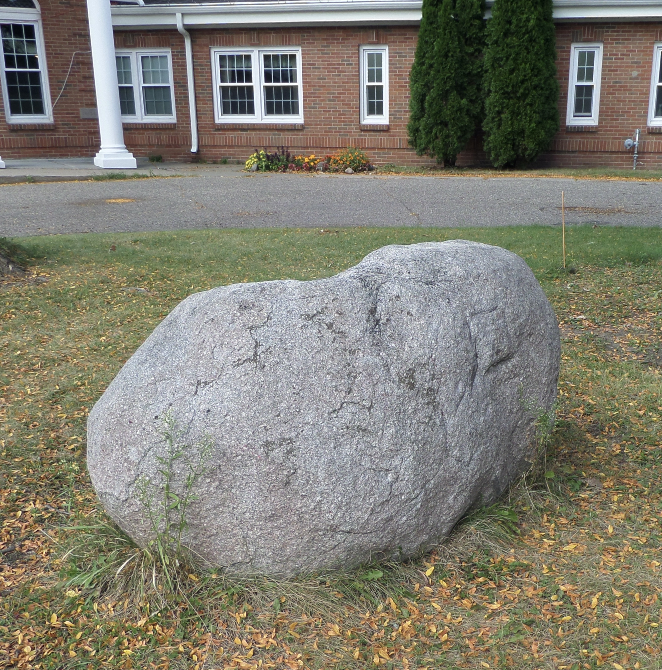
Red Rock at the Newport MN Methodist Church August 2020.
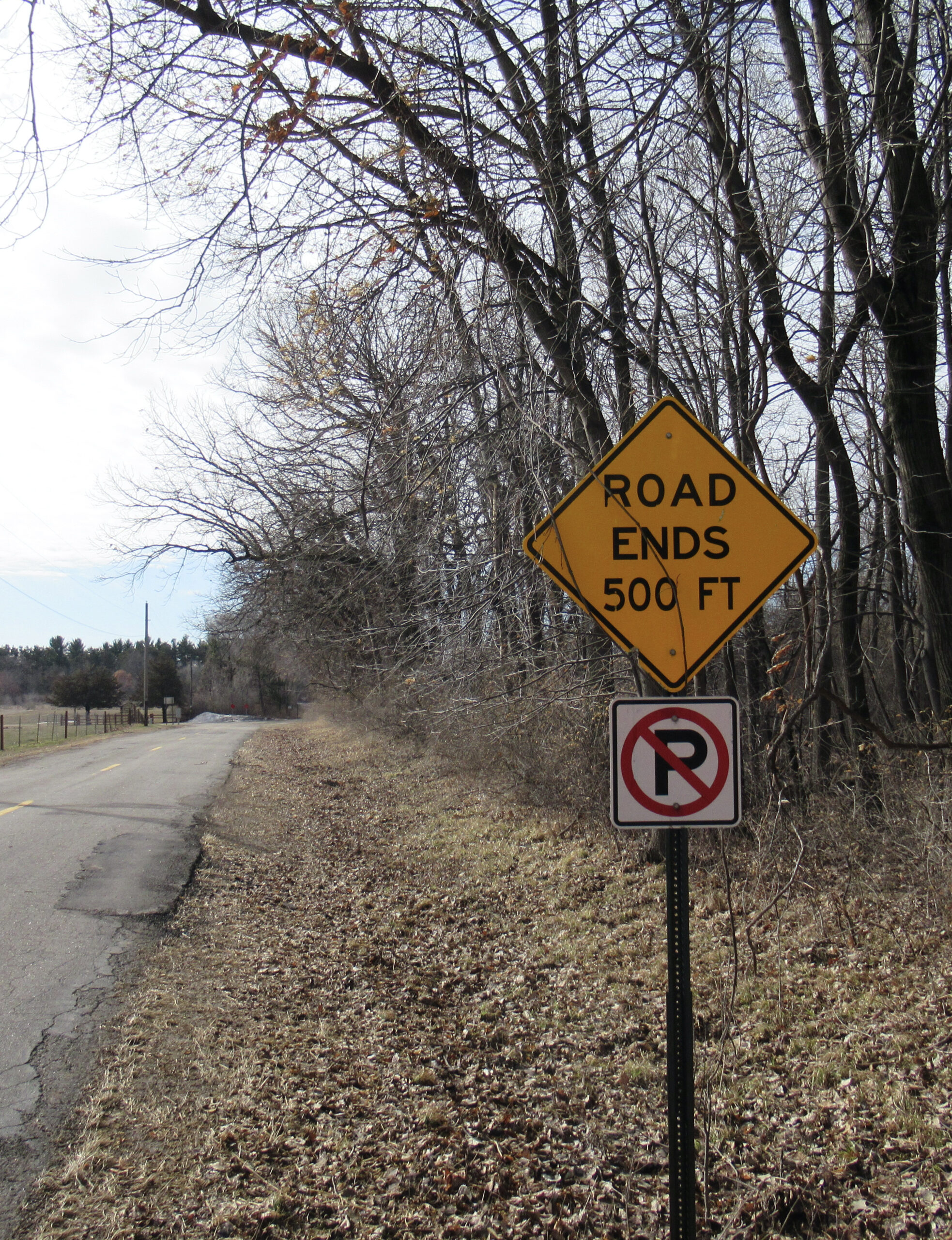
Today, people live on Gray Cloud island, but not many. There are no businesses – at least none I’ve seen. A Bible camp (to the best of my knowledge unused in the Covid year) is literally at the end of the road. There are no marinas, or such…it is a quiet country place.
Just out of St. Paul Park, there remains a mysterious building that appears much like a grain elevator such as I would have seen along railroad tracks in rural North Dakota of my youth. It is a “no trespassing” place, not much to be seen. It’s location would be adjacent to the river, the railroad is perhaps a half mile behind the photographer.
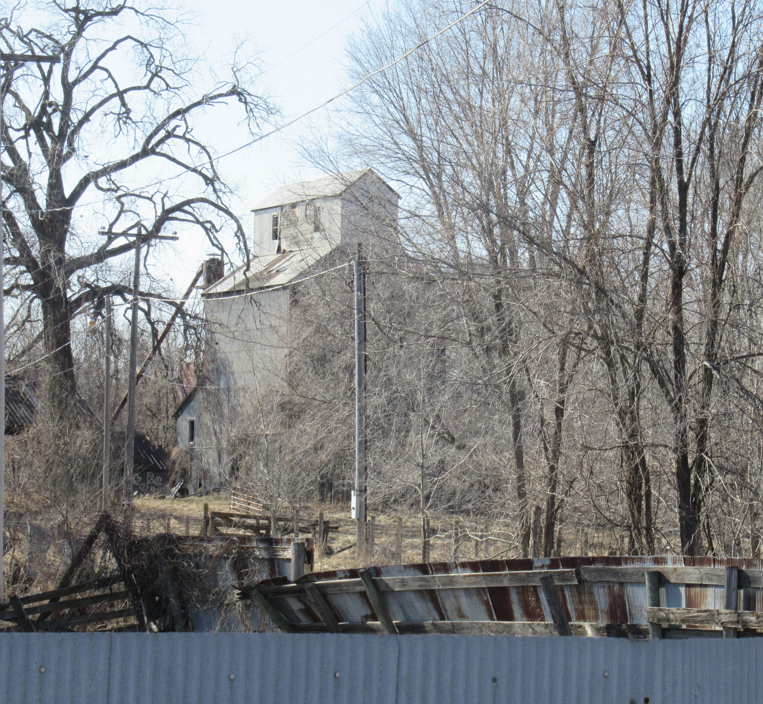
Building that appears to have been a grain elevator just outside St. Paul Park MN, March 2021
The west side of the island – actually almost all of the islands today – is or has been a source of sand, and not accessible to tourists like myself. This seems to be the long-time province of Aggregate Industries, a presence on the west side of the island since 1957.
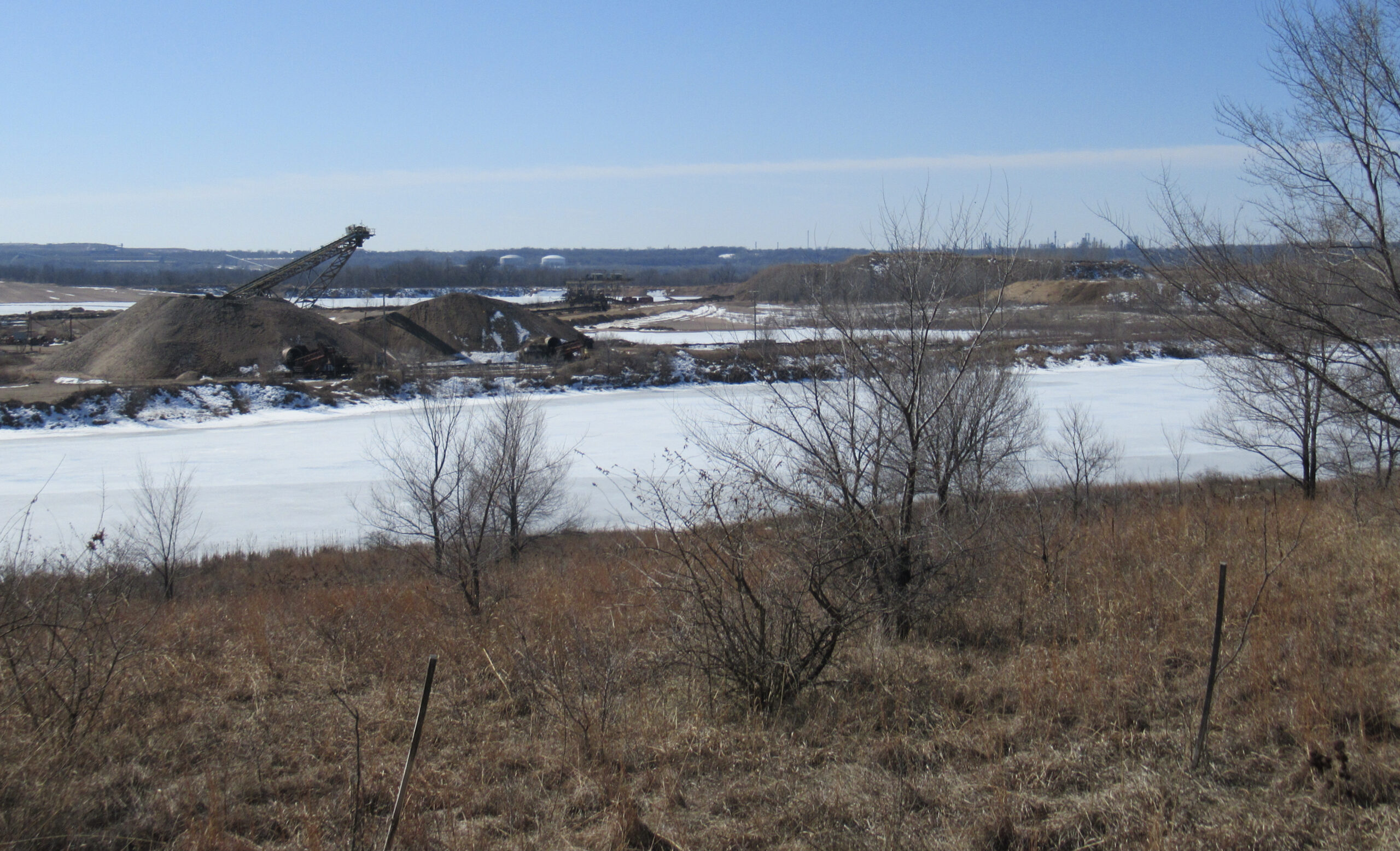
Sand mining on Gray Cloud Island. In the far background at right the oil refinery along U.S. Hwy 52 is visible. The frozen water surface in foreground is simply a pond – the Mississippi is beyond the sand and before the refinery.
There’s a solar farm on the island; and an FCC Tower. There remain a few farm fields.
A few Frenchmen visited in the 1600s, and were the first whites here. White settlement in the area of the Twin Cities began in about the 1820s roughly coincident with the building of Ft. Snelling, and increased rapidly beginning in the 1840s. A nationally sponsored event called the Grand Excursion in 1854 excited interest in settlement, and in 1858 Minnesota became a state.
The Mississippi River was always the only ‘superhighway’ to this area until the railroad reached what is now the twin cities in 1867. All the boat traffic passed by this island.
Gray Cloud today seems a hospitable place, though at least one resident makes it clear that visitors are not welcome down his or her road. To each his own.
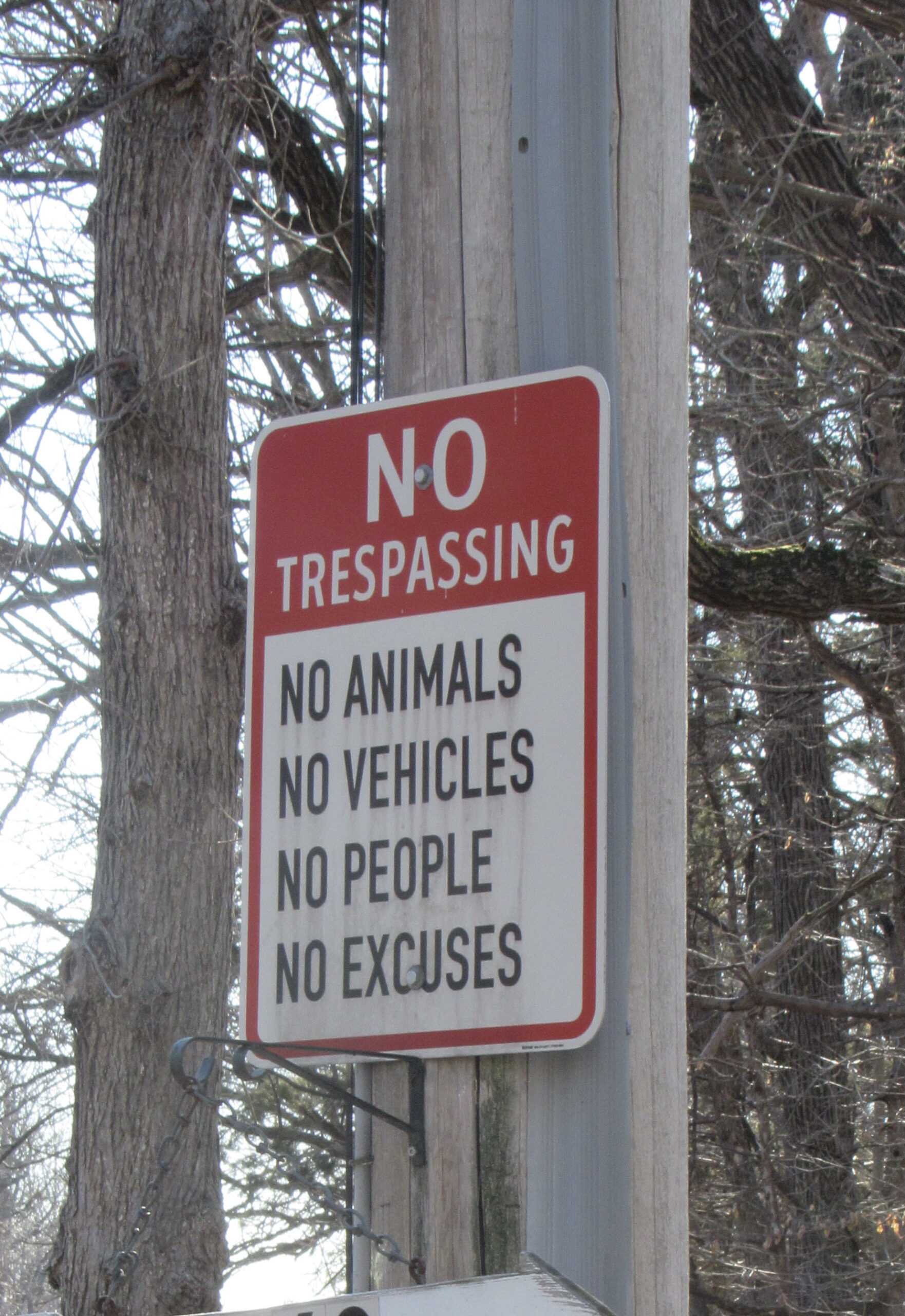
I wonder what the neighbors think of this. On the other hand, maybe the warning is to wandering outsiders, like me.
A drive through Gray Cloud is an opportunity to revisit a quiet place and time within this metropolitan area of 3 million people. Most convenient access is through West St. Paul on Co Rd 75 going south. In a couple of months you’ll begin to see the signs of spring and summer – probably a corn field or two, etc. Take the trip. You’ll enjoy it.
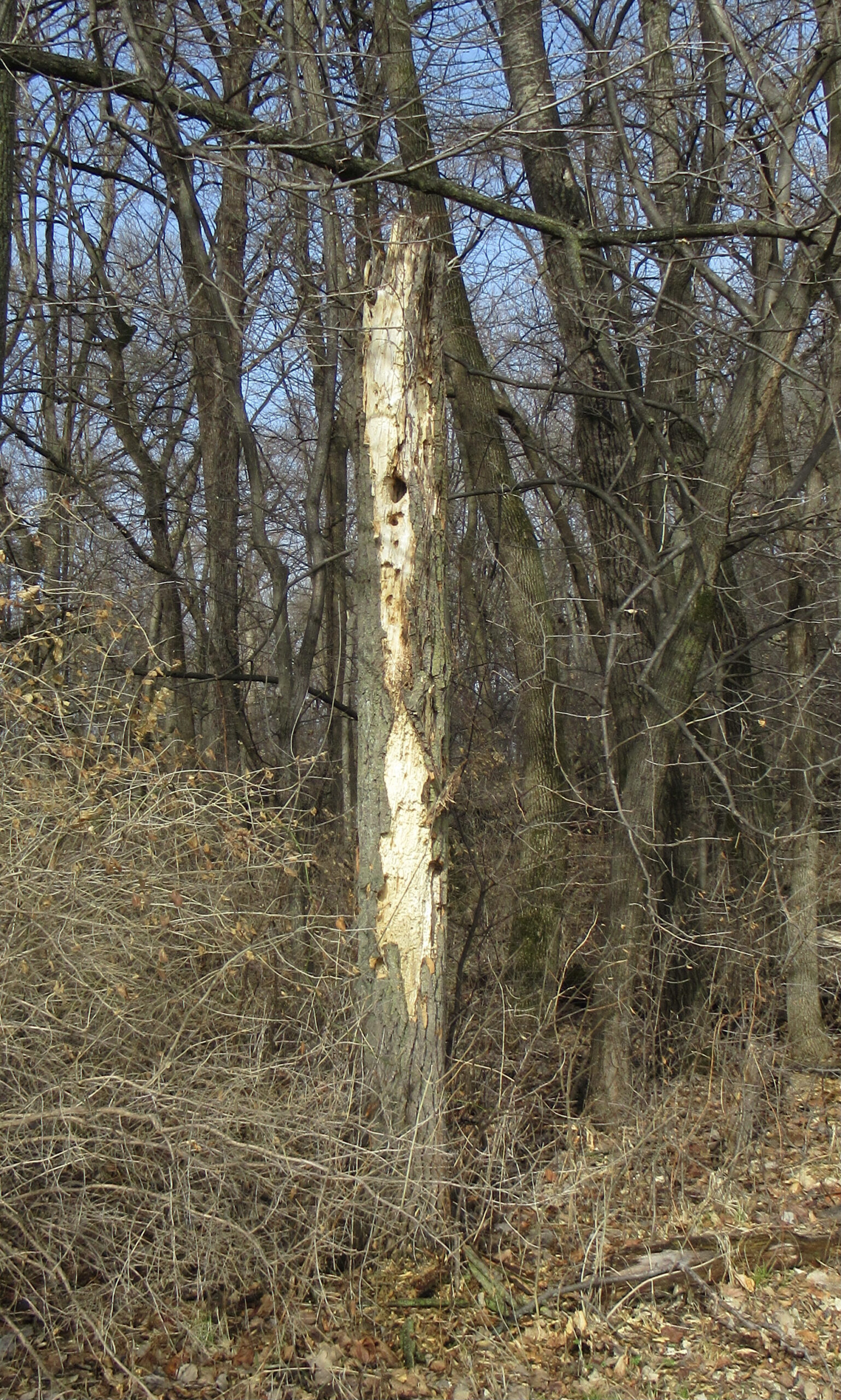
A tree re-purposed….
COMMENTS at the end of this post.
I suppose that even in a catastrophe such as the pandemic, there are a few silver linings. Similar to your daily explorations, I’ve been inspired to get out and walk 3–8 miles most days. Sometimes I will venture over to the state park near my house, but more often I leave my cheesehead and Packer regalia at home, and cross the border into Minnesota where I’ve been exploring various Twin Cities’ neighborhoods. Just pick an area, park in the neighborhood, and set out walking. It’s a great way to explore parts of the cities that you’d never need to venture into in your car. Being well into geezerhood, the only things to really worry about are remembering where I parked the car and where one might find public restrooms. Keep up the explorations!
I especially relate to your phrase “…where I parked the car…”! Not quite true, yet, but I don’t venture out of sight of it either. I was a latecomer to the cell phone, and today only have a flip-phone, but I never go anywhere without it these days, whereas 25 years ago I don’t think I could have imagined carrying a telephone around with me. It was somewhere about 25 years ago that I was sitting in a restaurant in Apple Valley, and a woman in a nearby booth was talking loudly to herself. Well, you know…. When I was leaving I noticed she had been on the cell phone of the day – the one that looked like a walky-talky, the ‘cell phone’ of Army days. Actually, one of my earliest blogs at this space was back in the summer of 2010. I was walking in Carver Park and an older man walking toward me was obviously having a serious problem. He said it was his heart, and he knew he couldn’t walk home. He didn’t have a phone; mine, I’d left at home. I asked where he lived, but I didn’t have a pencil to write down the address. I ended up walking the half-mile or so to the nearest street, where I flagged down a motorist who happened to be a Mom with kids heading to her nursing class in White Bear Lake. She called 9-11, and they dispatched an ambulance, while she drove down to where I’d left the man. (She trusted this stranger, me, to ride along). By then, he was doing better, sitting on a bench, and she drove him back to the ambulance at the entrance to the park. By now there was the ambulance and at least two police cars. All ended fine. They took him to the emergency room at the hospital. It turned out that he did have serious heart problems, and he was on some heavy duty new medicine that had slowed his heart rate, but he was trying to exercise as usual, and it was not a good decision.
Lesson learned: low tech has its limits. I still only have a flip phone but it’s far better than none. (The blog about the incident was August 3, 2010, entitled Infrastructure: https://outsidethewalls.org/blog/218-dick-bernard-infrastructure/)
Another great post – thank you!
As a life-long Methodist, I heard often of Red Rock, of course, but never visited there. I grew up in north central Minnesota and enjoyed driving on some of the very narrow dirt roads in the ditch bank area north of my home town. The area had been “opened up” with ditching to accommodate homesteaders trying to eke out a living on the land with their 160-acres that would be theirs if they hung around working on those acres for five-years. I came across many abandoned farms and farm buildings that indicated that some dreams had never been fulfilled! I also enjoyed driving along the many section roads around Minot AFB when I was stationed there with the USAF coming across many shelterbelts that had been planted in an attempt to push back or control the conditions that led to the Dust Bowl. There were also ,lots of the old elevators like the one in Dick’s photo often with a small rail siding to serve it all of which had long since been abandoned. I also remember traveling some roads near the Garrison Reservoir area and coming across old abandoned large steam shovels that had been used during the heyday of soft coal, ,i.e. lignite, strip mining. Some of those strips had filled in with water and had become essentially narrow lakes or ponds. Of course, I always came across lots of signs in all number of places stating welcome to North Dakota, home of Dick Bernard as well but…!
I’ve been “wandering” more during Covid, mostly on foot, so resonate with your travels, bathrooms and car re-locations are both on my mind.
For the first 60 days of 2021 I committed to walking 60 miles. (60 miles in 60 days) I completed that by March 2 with a few miles extra.
Am continuing to walk but no written down goal at this time.
Dick, Thank you for this posting that has placed Grey Cloud Island on the top of my list of local places to visit this summer. Growing up on the west side of the River I’ve long thought about this island and what it held. The Mississippi was in fact the first and only super highway in this area during the 19th Century so there must be remains of much settlement along and near the River, all ripe and waiting for us to explore.
If you come this way, let me know and we’ll do the tour, as I know it.
Lovely adventure! Keep exploring – clears our heads and gives us a new lease on life!
Lovely. It,s great to find the hidden gems. Thanks for the photos as well.